Field notes
Five Areas of Greece From the Capital: Your Questions
Which five areas can you reach from the capital in a day? Answers on Evia, Aegina, Argolis, Cape Sounion and Delphi, with distances and ferry times.
The country works as a year-round destination, and its capital doubles as the most convenient launching point for day trips in any direction. Travellers on our Goldenlark Excursions routes ask the same five questions again and again: which island, which peninsula, which sanctuary, and how far is each one. The answers below cover five areas, all reachable in a day, ordered roughly from nearest to farthest. Forum threads on the same subject usually collapse into arguments about roads; these answers stick to distances, boats and what you actually see.
Why start with Evia, and what is in Chalcis?
Because it is only 80 kilometres away, which makes Chalcis, the chief town of the island, a favourite short-break escape for people who live in the capital. The name survives from antiquity and comes from the Greek word for copper, chalcos, although no mine traces have ever been found in the area. The town rewards a slow day.
- Karababa Castle, an Ottoman fortress above the water.
- The archaeological museum, filled with finds from many periods.
- The Church of Saint Paraskevi, patron saint of the town.
- A bust of Aristotle, whose Chalcidice colony was founded from here.
- The two bridges that link the island to the mainland.
Walk the seafront with an ouzo or a tsipouro and a local bite in one of the tavernas, and in summer add the beach at Alykes Drosia, where beach bars and more tavernas line the sand.
What about Eretria, further south on Evia?
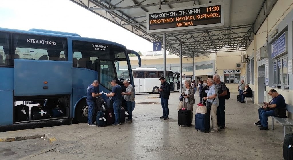
It is a traditional fishing village 20 kilometres south of Chalcis with history reaching back to Neolithic times and habitation running unbroken to the Roman era. Stroll the promenade, look at the abandoned islet locals call the island of dreams, and finish at the ancient theatre, the Macedonian tombs of the Erotes and the museum holding finds from the ancient acropolis. Ferries leave Eretria port roughly every hour and reach Oropos on the mainland in about 20 minutes; from there it is a 50 kilometre drive back to the capital, easily done before dinner.
Is Aegina worth the ferry?
Yes, and the crossing from Piraeus takes only about an hour and a half. Tradition ties the island's name to Aegina, mother of the hero Aeacus, who was born on the island and became its king. Beyond beaches and seafood tavernas, the island carries an unusual amount of history for its size.
- The Temple of Aphaea, named for a goddess later linked with Athena, which once formed an equilateral holy triangle with the Parthenon and the temple of Poseidon at Sounion.
- The Monastery of Agios Nektarios, dedicated to a recent saint of the Greek Orthodox Church.
- The statue of Ioannis Kapodistrias, the first administrator of free modern Greece, in the principal square.
- The Tower of Markellos, a Venetian-era watch tower bought around 1802 by revolutionary leader Spyros Markellos, later the seat of the temporary government in 1826-28.
The strangest sight is the orphanage Kapodistrias built in 1828-29 for children of the War of Independence. Known locally as The Prison, it later housed schools, workshops, the National Public Library, an early archaeological museum, a military academy, the National Printing Office and a conservatory, before serving as an actual prison from about 1880 and holding political prisoners under the junta of 1967-74. Restoration into a museum is planned. Near the village of Pachia Rachi, a 13th century Byzantine church stands on the ruins of a 4th century BC temple of Zeus Hellanios, its staircase and scattered older stones still visible.
What should you eat and swim at on Aegina?
Pistachios, without hesitation. Fistiki Aeginis earned Protected Designation of Origin status in 1996, and the island's drought climate and volcanic soil produce a nut considered better than many foreign varieties. For swimming, head south to the settlement of Perdika and take the small boat to the uninhabited islet of Moni, a ten minute sail costing 5 EUR per person. The water is clear, the beach is quiet, and the islet is a game-breeding park where the animals roam loose and mingle with visitors on the sand.
What does the Argolis day look like?
Argolis sits in the eastern Peloponnese and is regarded as one of the loveliest parts of the country for its sites, its town architecture and its combination of plains and beaches. A driving day along the coastal national highway runs roughly west then south. Stop first at the Corinth Canal, which links the Aegean with the Corinthian Gulf and carries real strategic weight for the country, and take your photographs from the bridge. Continue to the ancient theatre of Epidaurus, among the best preserved classical theatres anywhere and still in use thanks to its acoustics, then to the Asklepion, a UNESCO-listed site and birthplace of the healing god Asklepios, son of Apollo.
The Epidaurus performances belong to the annual festival that spreads ancient drama across eight summer weekends and draws more than 90,000 theatre-goers a year. After the sanctuary comes Mycenae, a military stronghold that dominated much of southern Greece, Crete, the Cyclades and parts of southwest Anatolia, and gave its name to the period from about 1600 to 1100 BC. Walk the Royal Tombs, the Cyclopean Walls, the Lion Gate and the Treasury of Atreus, a beehive tomb raised around 1250 BC.
How do you finish an Argolis day?
In Nafplion, the first capital of modern Greece, over lunch in a traditional restaurant and an ice cream from a proper Italian gelateria. The Venetian fortress of Palamidi looks over the town, and the fortified islet of Bourtzi sits in the bay. Locals insist there are 999 steps to the top of the castle, a number restaurants play with on their menus, though the winding stair from town counts 913 and reaching the summit takes over a thousand. Wander the old town's multicoloured houses and narrow graffitied alleys, then end with the promenade or the Acronafplia quarter, which was a separate town until the Venetians and Franks folded it into the fortifications in the 13th century.
What is Cape Sounion exactly?
The promontory at the southernmost tip of the Attic peninsula, 8 kilometres south of Lavrio, the ancient Thoricus, and 69.5 kilometres southeast of the capital, inside the municipality of Lavreotiki in East Attica. It is known for the Temple of Poseidon, a major monument of the Golden Age, its remains standing at the headland edge with the sea on three sides. The drive out follows the scenic coast road past Glyfada, Vouliagmeni and Varkiza, then through the national park past vineyards and olive groves to the village of Agios Konstantinos, where the Chaos, a spectacular collapsed mining stoa, opens in the ground.
The Doric temple went up in the late 5th century BC under Pericles. Homer and Herodotus already called the headland holy, habitation traces reach back to 2800 BC, and the spot served as a watchtower guarding the sea lanes to Piraeus and the nearby silver mines. Myth adds a darker story: Aegeus, waiting for his son Theseus returning from Crete, saw a black sail instead of the promised white one and threw himself into the sea, which took his name, the Aegean.
Why is Delphi on every list?
Because it was considered the centre of the world. The sanctuary lies at the foot of Mount Parnassos, in the angle of the twin Phaedriades rocks, about 170 kilometres from the capital, and held the most trusted oracle of ancient Greece between the 6th and 4th centuries BC. The priestess Pythia delivered the prophecies and the priests of Apollo interpreted them. Pilgrims came from across the known world, and the stone called the omphalos, the navel, marked the spot where two eagles released by Zeus were said to meet. Management of the precinct was eventually taken from the Phocians, who had been squeezing visitors for money, and handed to an amphictyony drawn mainly from central Greece.
On the road in, stop at Kryas Springs near Levadia, a valley of streams, limestone formations and bridges made for a short walk, and climb to the ancient theatre of Levadeia. At the site itself, see the Treasury of the Athenians, the Temple of Apollo, the Athenian Stoa and the Polygonal Wall, then the museum with the Naxian Sphinx, the statue of Antinoos, the frieze of the Siphnian Treasury and the bronze Charioteer.
Where do you eat near Delphi?
In Arachova, 10 kilometres away on the Parnassos slopes, a village of narrow alleys, hand-woven carpets and food shops selling Formaela cheese and traditional pasta. It has become the country's most cosmopolitan winter resort thanks to its modern ski centre, its closeness to the capital and its nightlife, and it sits 35 kilometres west of Livadeia. Lunch there, buy cheese, and drive home through the mountains.
The question worth asking before any of these is not which area is best but which direction the day allows: water to the southwest, mountain to the north, and the answer usually presents itself.
Written by the Goldenlark Excursions team. Routes are checked on the ground and pages are edited in place when something changes. Spotted an error? Tell us and we will fix it.
Next step
Let us plan the next one
A short brief is enough. We reply with questions, a route sketch and what it would cost before you commit to anything.